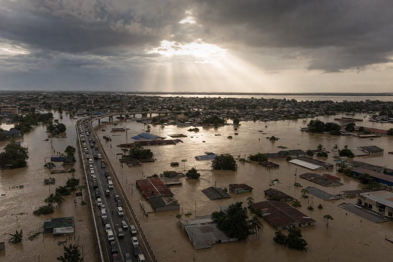
Floods are increasingly becoming a common challenge in urban areas, exacerbated by climate change and rapid urbanization. The urgency to implement effective flood management techniques has never been greater, especially as cities like Houston and Venice grapple with frequent inundations.
Advanced Flood Prediction and Early Warning Systems
The foundation of effective flood management is accurate prediction and timely warnings. The European Flood Awareness System (EFAS) and the US-based National Weather Service (NWS) employ sophisticated models to predict flood events. These systems use a blend of satellite data, weather forecasts, and hydrological models to provide early warnings, giving cities precious time to prepare. Implementing such systems involves the integration of advanced software like HEC-RAS and MIKE FLOOD, which simulate flood scenarios and help urban planners develop robust flood response strategies. Additionally, the role of AI in enhancing the accuracy of these predictions cannot be overlooked. For instance, Google’s Flood Forecasting Initiative utilizes machine learning to predict flood events in India and Bangladesh, demonstrating the potential of AI-driven solutions in flood management.
Community Involvement and Public Awareness
Engaging communities in flood management efforts is crucial for building resilience. Public awareness campaigns can educate residents about the risks and preparedness measures, enhancing community readiness. Social media platforms and mobile apps can disseminate real-time flood alerts, safety tips, and evacuation routes. For example, the MyCoast app in the US allows citizens to report flooding incidents, which helps authorities track and respond to flood events more effectively. Educational programs in schools and community centers can further instill a culture of preparedness and resilience.
Venice’s MOSE Project
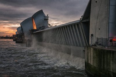
Venice, Italy, is a city perpetually at risk of flooding due to its unique geography. The MOSE (Modulo Sperimentale Elettromeccanico) project is an ambitious initiative aimed at protecting the city from high tides and sea-level rise. This system comprises a series of mobile gates installed at the lagoon’s inlets, which can be raised to prevent seawater from entering the city during high tides. Despite some technical and financial challenges, the MOSE project represents a significant step forward in urban flood management, combining engineering ingenuity with environmental considerations.
Infrastructure Improvements and Urban Planning
Modern urban planning must prioritize flood resilience. This involves designing and upgrading infrastructure to manage and mitigate flood risks. Green infrastructure, such as permeable pavements, green roofs, and rain gardens, plays a vital role in absorbing and diverting rainwater. Cities like Copenhagen have pioneered the use of blue-green infrastructure to create urban spaces that are both aesthetically pleasing and flood-resilient. Additionally, retrofitting existing buildings with flood-resistant materials and elevating structures in flood-prone areas can significantly reduce damage during flood events.
Legislation and Policy Frameworks
Effective flood management is underpinned by robust legislative and policy frameworks. In Europe, the Floods Directive (2007/60/EC) mandates member states to assess and manage flood risks, ensuring comprehensive flood risk management plans are in place. The US follows the National Flood Insurance Program (NFIP), which encourages communities to adopt and enforce floodplain management regulations. These regulations often include zoning laws that prevent construction in high-risk areas, thereby reducing the potential for flood damage. Additionally, the implementation of incentives, such as tax breaks or grants for flood-proofing properties, can motivate individuals and businesses to invest in flood resilience.
Technological Innovations in Flood Management
Alongside these engineered and technological approaches, natural flood management techniques — slowing and storing water upstream using the landscape itself — remain a valuable complement rather than a replacement for the systems below.
Advancements in technology offer promising solutions for flood management. The use of drones for flood monitoring provides real-time data and imagery, aiding in quick response and damage assessment. Remote sensing technologies, such as LiDAR, help create detailed flood maps that inform urban planning and emergency response. The Internet of Things (IoT) also enables the deployment of smart sensors in rivers and stormwater systems, providing continuous monitoring and early warning capabilities. For instance, the Smart City initiative in Singapore employs a network of sensors to monitor water levels and weather conditions, triggering automatic responses to mitigate flooding.
International Collaboration and Knowledge Sharing
Global cooperation is essential for advancing flood management practices. Organizations like the World Meteorological Organization (WMO) and the International Strategy for Disaster Reduction (ISDR) facilitate the exchange of knowledge and best practices among countries. Collaborative projects, such as the EU’s Horizon 2020-funded projects on flood resilience, bring together experts from various fields to develop innovative solutions. Learning from successful initiatives in other regions can help cities adopt proven strategies and technologies, enhancing their flood resilience.
Nature-Based Urban Flood Management
Not every urban flood management solution involves concrete and steel. A growing number of cities are reconnecting rivers to their natural floodplains, restoring urban wetlands, and daylighting streams that were previously routed underground into culverts and storm drains. These approaches work with the water’s natural behaviour rather than only trying to contain it: a restored floodplain gives a swollen river somewhere to spread out and slow down before it reaches homes and businesses, reducing peak flood levels downstream.
China’s “sponge city” initiative is one of the more ambitious examples of this approach applied at scale, combining permeable surfaces, constructed wetlands, and expanded urban green space across dozens of participating cities with the explicit goal of absorbing and storing rainwater rather than immediately shedding it into overwhelmed drainage systems. The Netherlands has taken a related but distinct approach through its “Room for the River” program, which widens river channels and lowers floodplains at strategic points specifically to give major rivers more capacity during peak flow, rather than continuing to raise levees indefinitely.
These nature-based approaches tend to deliver secondary benefits that purely engineered flood defences don’t: restored wetlands support biodiversity, improve water quality by filtering pollutants, and often become genuinely valued public green space rather than infrastructure residents simply tolerate. The trade-off is that they typically require more land than a comparable engineered solution and can take years to mature into their full flood-buffering capacity, which is part of why most cities pair them with, rather than substitute them for, traditional grey infrastructure.
Measuring Whether Urban Flood Management Is Actually Working
A city can spend heavily on flood infrastructure and still not know whether it’s genuinely reducing risk until the next major storm arrives. A few practical indicators help track progress between events:
- Time-to-warning — how far in advance residents and emergency services receive an actionable flood alert — is one of the more directly measurable outcomes of a prediction and early-warning investment, and it tends to improve steadily as forecasting models and sensor coverage mature.
- Impervious surface coverage, the share of a catchment area covered by pavement, roofing, and other surfaces water can’t soak into, is a leading indicator of flood risk. Cities actively replacing impervious surface with permeable pavement and green infrastructure should see this figure trend down over time.
- Claims and losses per flood event, even where imperfect as a single metric, tend to fall over successive comparable storms in cities where floodplain zoning, building codes, and infrastructure upgrades are genuinely reducing exposure rather than just relocating it.
- Post-event recovery time — how quickly roads, utilities, and transit reopen after a flood — reflects both the resilience of infrastructure itself and the effectiveness of a city’s emergency response planning.
None of these figures move in a straight line, since a single unusually severe storm can outweigh years of gradual infrastructure improvement. That’s part of why flood management is generally evaluated over a run of events rather than any single one.
Flood Insurance and Risk-Transfer Alongside Physical Defenses
No urban flood management program, however well engineered, eliminates flood risk entirely, which is why insurance and other risk-transfer mechanisms remain a necessary complement to physical infrastructure rather than a separate concern. A city can invest heavily in prediction systems, green infrastructure, and hardened defenses and still see residents left financially exposed if the underlying flood-insurance market doesn’t keep pace with that changing risk picture.
This has become a genuine tension in a number of flood-prone markets: as flood risk becomes better mapped and better understood, insurers price policies more accurately to reflect it, which in some previously underpriced high-risk areas has meant premiums rising faster than local incomes, or in the more extreme cases, private insurers declining to offer coverage at all. Programs like the US National Flood Insurance Program exist partly to keep coverage available in markets where private insurers have pulled back, though that stability comes with its own long-running debate about whether subsidized public flood insurance inadvertently keeps development concentrated in high-risk floodplains that a fully risk-priced market would otherwise discourage.
The practical takeaway for a city building an urban flood management strategy is that insurance, zoning, and physical infrastructure need to be planned together rather than treated as separate departments’ problems. A city that hardens its drainage system but keeps issuing building permits in the newly protected floodplain, without updating its actual flood-risk maps and insurance requirements accordingly, can end up encouraging exactly the development pattern its infrastructure investment was meant to reduce risk from.
Funding and Financial Support for Flood Management
Securing adequate funding is crucial for implementing effective flood management strategies. Governments and organizations offer various grants and financial support to assist in these efforts. Here are some key funding sources:
- Federal Emergency Management Agency (FEMA): Provides grants for flood mitigation projects in the US, including the Hazard Mitigation Grant Program and the Pre-Disaster Mitigation Program.
- European Union Solidarity Fund (EUSF): Assists EU member states affected by major natural disasters, providing financial aid for emergency response and recovery efforts.
- World Bank: Offers financial and technical support for flood risk management projects in developing countries through initiatives like the Global Facility for Disaster Reduction and Recovery (GFDRR).
- Private Sector: Engaging private companies in public-private partnerships can unlock additional funding and resources for flood management projects.
In conclusion, effective flood management in urban areas requires a multifaceted approach, combining advanced prediction systems, community involvement, resilient infrastructure, supportive legislation, and technological innovations. By adopting these strategies and fostering international collaboration, cities can better prepare for and mitigate the impacts of flooding, protecting lives and property while promoting sustainable urban development.
Frequently Asked Questions
What is the most important tool for managing urban flooding?
+
Accurate prediction and early warning. Systems like the European Flood Awareness System (EFAS) and the US National Weather Service combine satellite data, weather forecasts and hydrological models to give cities time to act before water levels rise — everything else, from evacuation to sandbagging, depends on that lead time existing at all.
How does Venice protect itself from flooding?
+
Venice's MOSE (Modulo Sperimentale Elettromeccanico) project uses a series of mobile gates at the lagoon's inlets that can be raised to block high tides and storm surges from entering the city — a large-scale mechanical barrier rather than a passive defense.
What is green infrastructure in the context of flood management?
+
Green infrastructure refers to permeable pavements, green roofs and rain gardens that absorb and divert rainwater rather than letting it overwhelm storm drains. Cities like Copenhagen combine these with traditional grey infrastructure to create flood-resilient public spaces.
Do building codes actually help prevent flood damage?
+
Yes — zoning laws that restrict construction in high-risk floodplains, paired with programs like the US National Flood Insurance Program (NFIP), reduce how much property sits directly in harm's way, which does more to limit total damage than any single piece of flood-control engineering.
What role does technology play in modern flood response?
+
Drones provide real-time monitoring and damage assessment, LiDAR-based remote sensing creates detailed flood maps for planning, and IoT sensor networks — like the ones used in Singapore's Smart City initiative — track water levels continuously and can trigger automated responses.
Who funds flood management projects?
+
Funding comes from a mix of sources: FEMA's Hazard Mitigation Grant Program in the US, the European Union Solidarity Fund for member states hit by major disasters, World Bank programs like the Global Facility for Disaster Reduction and Recovery in developing countries, and public-private partnerships.
What is the EU Floods Directive?
+
The Floods Directive (2007/60/EC) requires EU member states to assess flood risk and maintain comprehensive flood risk management plans — a legislative backbone that standardizes how flood risk gets evaluated and mitigated across the bloc.
Can technology alone solve urban flooding?
+
No — the cities making real progress combine prediction systems, resilient infrastructure, supportive legislation and public engagement together. A sensor network without zoning reform, or a warning system without community buy-in, each solves only part of the problem.